cca 1910 G. Freytag&Berndt's Automobil- und Radfahrerkarten, Blatt 40.: Schweiz und Italien. Verlag der Kartographischen Anstalt, G. Freytag&Berndt GmbH, Wien. Svájc és Észak-Itália autó- és biciklitérképe, jelmagyarázatokkal, 1:300000, 64,5×53 cm
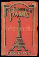
cca 1920-1930 Plan Monumental Paris & Environs. Guide commode pour voir et visiter les monuments de paris. Paris, é.n, A. Leconte, francia nyelven, 56x74 cm.
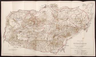
cca 1880 Az Osztrák-Magyar Monarchia textilipara. Nagyméretű térkép. 1:500 000 92x72 cm / large map of the Textile Industry of the Austro-Hungarian Monarchy. 92x72 cm
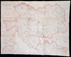
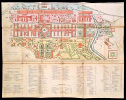
1873(?) Wien Ausstellungsplan vászonra kasírozott Bécs világkiállítás térképe 1:3000, 60×46 cm /
1873(?) Map of Vienna Exhibition / Wien Ausstellung, on canvas, 60×46 cm
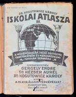
3 db vegyes állapotú atlasz - 1935 Barthos-Kurucz: Egyetemes Történelmi Atlasz(firkás, ragasztott, hiánytalan), 1937 Dr. Kogutowicz Károly iskolai atlasza(hiánytalan), 1934 Dr. Kogutowicz Károly iskolai atlasza(hiányos, helyenként firkás)
Die Webseite von Darabanth GmbH nutzt Cookies, um Ihnen die bestmögliche Surferfahrung zu garantieren. Durch das Weitersurfen auf dieser Webseite stimmen Sie der Verwendung der Cookies automatisch zu.