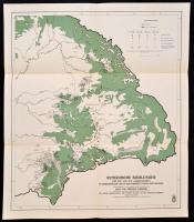
1943 Rumänische Siedlungen des XIII. und XIV. Jahrhunderts in Siebenbürgen und in den übrigen Teilen Ostungarns, lépték nélkül, a Siebenbürgen und seine Völker (Szerk.: Mályusz Elemér. Bp.-Lipcse-Mailand, 1943, Danubia) kötetből, 53×45,5 cm
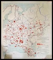
1941 Die Bevölkerungsdichte der europäischen Russland innerhalb der Grenzen Sowjetunion von 1941 Stuttgart, 1941. Karten Abteilung des Deutschen Ausland Instituts und der Publikationsstelle Berlin-Dahlem./ Map of the Russian occuppied territories. 73x90 cm
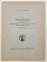
Memoriale sulla questione della Bessarabia e della Bucovina settentrionale. Bukarest, 1940, Accademia romena. Vitairat Besszarábia és Észak-Bukovina szovjet megszállásáról, Besszarábia és Észak-Bukovina néprajzi térképével. Tűzött papírkötésben, felvágatlan példány.
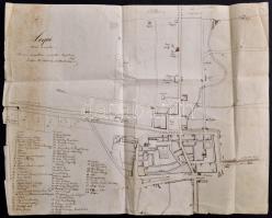
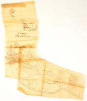
1862 Kápolnay István (?-?): Acqui Terme és vidékének saját kézzel rajzol térképe, (Alessendriához közel (Piedmont régióban), az egyik szélén és az alján szakadásokkal, 35x44 cm "Szomorú napokban mázolta Kápolnay Pista. Genfben 1862. októberben emlékezet után." Kápolnay István ismert garibaldista, feltehetőleg a szomorú napok az Aspromontei vereséget jelölik, ahol maga Garibaldi is megsebesült./ ...
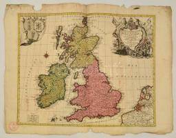
1764 Tobias Conrad Lotter (1717-1777): Nagy Britannia és Írország rézmetszetű térképe. La Grande Bretagne ou les Royaumes d'Angleterre et d'Ecosse comme aussi le Royaume d'Irlande. Lotter, Tobias Conrad. / Large map of Great Britain and Ireland. Colored etching. 58x49 cm
"Hungariae et Regionum, quae ei quondam fuére uintae ut Transilvaniae, Valachiae, ...", Frederici De Wit, amszterdami, 1688-as kiadás modern reprintje, ofszet, 51x99 cm
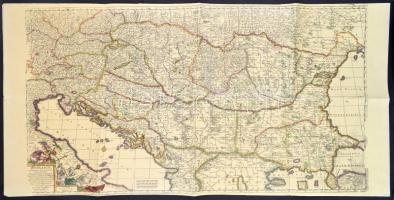
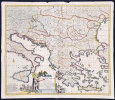
Justus Danckerts (1635-1701) cca 1688-1692 között készült Regni Hungariae, Graeciae, et Moreae ac Regionum című térképének modern, reprint kiadása, ofszet, kis szakadásokkal a szélén, 53x62 cm
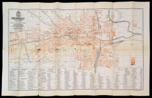
1936 Miskolc thjf. város, 1:10.000, tervezték: Szűcs Sándor, Dr. Vigyázó János, készítetté: Tóvári János. Kiadja: Turistaság és Alpinizmus. Bp., 1936, M. Kir. Állami Nyomda, a hajtások mentén szakadásokkal, 50x84 cm