https://bid-notification.darabanth.com:443
https://www.darabanth.com/
https://static.darabanth.com/
https://static.darabanth.com/auction/img/
Tételek lista
Number of items: 122
Auction is over! Item soon called at the auction hall
Catalog number ascending
Catalog number descending
Starting price ascending
Starting price descending
12
24
48
72
2111648
12745
365
0
1800
Maps
Other collectibles
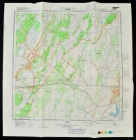
1979, 1990 Veszprém és Csongrád katonai térképe, 2 db, 48×53 cm
The item is not available
Starting price:
1 800 HUF
2111650
12746
365
0
1200
Maps
Other collectibles
1982 Nyírábrány katonai térképe, 47×47 cm
The item is not available
Starting price:
1 200 HUF
2111654
12747
365
0
1200
Maps
Other collectibles
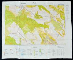
1981 Nyagysáp katonai térképe, 58×69 cm
The item is not available
Starting price:
1 200 HUF
2111659
12748
365
0
1200
Maps
Other collectibles
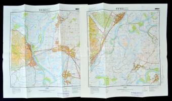
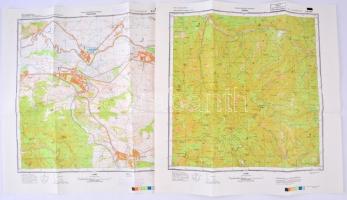
1977 Olaszliszka és Tokaj katonai térképe, 2 db
Starting price:
1 200 HUF
2111661
12749
365
0
1200
Maps
Other collectibles
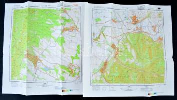
1988 Diósjenő és Sahy katonai térképe, 2 db
Starting price:
1 200 HUF
2111664
12750
365
0
1200
Maps
Other collectibles
1988 Csóványos és Drégelypalánk katonai térképe, 2 db
Starting price:
1 200 HUF
2109580
12751
365
0
6000
Maps
Other collectibles
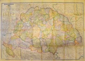
cca 1940 Magyarország közigazgatási térképe, tervezte: Kogutowicz Manó, 1:900.000, hajtásnyomokkal, szakadt, a papírtok szakadt, hiányos, 83x116 cm
Starting price:
6 000 HUF
2110622
12752
365
0
2000
Maps
Other collectibles
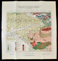
cca 1930-1940 Aszód és környékének földtani térképe, földtanilag felvette: Dr. Szentes Ferenc, 1:375.00, Bp. M. Kir. Földtani Intézet-M. Kir. Honvéd Térképészeti Intézet, 94x60 cm
The item is not available
Starting price:
2 000 HUF
2110566
12753
365
0
2000
Maps
Other collectibles
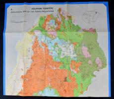
1976 Tokaji-hegység földtani térképe, Szerk.: Dr. Gyarmati Pál, Dr. Perlaki Elvira, Pentelényi László, Bp. Magyar Állami Földtani Intézet, 114x79 cm.
Starting price:
2 000 HUF
2110647
12754
365
0
1400
Maps
Other collectibles
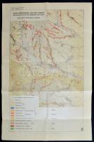
cca 1886 A Pojana-Ruszka nyugati felének és környékének átnézetes földtani térképe, Lóczy Lajos, 1:200.000, Bp. M. Kir. Földtani Intézet, (Grund V.-ny.), 44x42 cm
Starting price:
1 400 HUF
2110677
12755
365
0
2000
Maps
Other collectibles
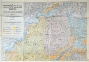
1941 A Tiszántúl földtani térképe, északi és déli rész, Szerk.: Sümeghy József, 1:200.000, Bp. M. Kir. Földrajzi Intézet,(M. Kir. Honvéd Térképészeti Intézet), 69x99 cm x 2
Starting price:
2 000 HUF
2090173
12756
365
0
1000
Maps
Other collectibles
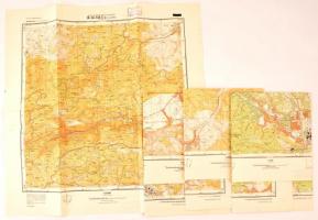
1976-1978 4 db topográfiai térkép borsodi, Miskolc-Lillafüred környéki településekről (Miskolc Ny., Lillafüred, Sajószentpéter, Bánhorváti), 1:25.000, Bp., Magyar Honvédség Térképészeti Hivatal, hajtásnyomokkal, 48x46 cm és 47x46 cm közötti méretben.
Starting price:
1 000 HUF
The bids are accepted according to the following bid increments:
up to 1.000 HUF
100 HUF
up to 5.000 HUF
200 HUF
up to 10.000 HUF
500 HUF
up to 20.000 HUF
1.000 HUF
up to 50.000 HUF
2.000 HUF
up to 100.000 HUF
5.000 HUF
up to 200.000 HUF
10.000 HUF
up to 500.000 HUF
20.000 HUF
up to 1.000.000 HUF
50.000 HUF
over 1.000.000 HUF
100.000 HUF
further page navigation Contact
Address:
Mailing Address:
Phone:
Fax:
E-mail
:
icvqw34r5 nf?3+ o@dasdfefg rabanwf34 th.codv4 m
Opening hours
Monday: 12-17
Tuesday-Wednesday: 10-17
Thursday: 10-19
Friday: closed
Weekend: closed
© 2011-2024 Darabanth Philatelic and Numismatic Auctions Co., Ltd.
We use cookies on the Darabanth website to enhance your user experience.
I agree
For details, please click here
https://www.darabanth.com/en/feltetelek/#privacy_policy
darabanth.com
Item added to the basket
Continue shopping